 |
Waimea-Bay
is located on the north shore of Oahu and is world renowned for its high waves during the winter months that can reach heights of up to thirty feet. Called a "natural wonder," Waimea Bay offers spectacular white sand beaches, lagoon and lava-rock points on either side of the Bay. An inland valley leads to a waterfall and a small lake. Waimea Bay is a world class surfing spot, but caution is advised during the winter when the swells are large and the water is fast and deadly. There is a strong riptide current running out at the center of the Bay and visitors are strongly cautioned to obey all postings and warnings. The hills on either side of the Bay are great for whale watching during the months of January through March. Waimea Bay Beach Park offers swimming during the summer months. The park also includes a sand and reef area, picnic areas, lifeguards, restrooms, showers and phones. The whole island of Oahu is, of course, filled with geographical wonders - the mountains, rainforests, waterfalls, volcanic craters and beaches. There is something here for everyone to see and do.
Surrounding areas: Pupukea, Hawaii (1.0 mi), Sunset Beach, Hawaii (2.4 mi), Ehukai Beach, Hawaii (2.5 mi), Kawela Bay, Hawaii (4.6 mi), Haleiwa, Hawaii (4.8 mi), Turtle Bay, Hawaii (5.8 mi), Waialua, Hawaii (6.2 mi)
|

|
Waimea Bay Vacation Rentals
|

|
|
|
|
|
Waimea Bay Hotels and Resorts
|
|
|
| | | Hotels & Motels |
| Hilton Turtle Bay Golf & Tennis Resort | 57-091 Kamehamaha Hwy | Kahuku, HI | 7.9 mi. | (808) 293-8811 | | Inn At Schofield Barracks | Holehole Ave | Wahiawa, HI | 10.1 mi. | (808) 624-9650 | | Inn At Schofield Barracks | 563 Kolekole Ave | Wahiawa, HI | 10.4 mi. | (808) 624-9650 | | Makaha Resort & Golf Club | 84-626 Makaha Valley Rd | Waianae, HI | 14.8 mi. | (808) 695-7534 | | Marriott JW Ihilani Resort | 92-1001 Olani St | Kapolei Oahu, HI | 21.1 mi. | (800) 535-4028 | | Ohana Honolulu Airport Hotel | 3401 N Nimitz Hwy | Honolulu, HI | 22.9 mi. | (808) 836-0661 | | Schraders Windward Marine Resort | Lihikai Dr | Kaneohe, HI | 23.0 mi. | (808) 239-5711 | | Best Western The Plaza Hotel | 3253 Nimitz Hwy | Honolulu, HI | 23.1 mi. | (808) 836-3636 | | Resort Quest At The Executive Centre Hotel | 1088 Bishop St | Honolulu, HI | 26.4 mi. | (808) 539-3000 | | Ala Moana Hotel | Atkinson Dr | Honolulu, HI | 26.8 mi. | (808) 955-4811 | | Aston At The Waikiki Banyan | 201 Ohua Ave # 406-2 | Honolulu, HI | 26.8 mi. | (808) 922-0555 | | Aston Honolulu Prince Hotel | Nahua St | Honolulu, HI | 26.8 mi. | (808) 922-1616 | | Aston Waikiki Circle Hotel | Kalakaua Ave | Honolulu, HI | 26.8 mi. | (808) 923-1571 | | Best Western Plaza Hotel | N Nimitz Hwy | Honolulu, HI | 26.8 mi. | (808) 836-3636 | | Coconut Plaza Hotel | Lewers St | Honolulu, HI | 26.8 mi. | (808) 923-8828 | | Colony's Pacific Manarch | Uluniu Ave | Honolulu, HI | 26.8 mi. | (808) 923-9805 | | Colony's Poipu Kai Resort | Poipu Rd | Honolulu, HI | 26.8 mi. | (808) 742-2229 | | Coral Reef Hotel | Kuhio Ave | Honolulu, HI | 26.8 mi. | (808) 932-1262 | | Ewa Kai Apartment Hotel | Kuhina St | Honolulu, HI | 26.8 mi. | (808) 689-7946 | | Halekulani Hotel | Kalia Rd | Honolulu, HI | 26.8 mi. | (808) 923-2311 | | Hanalei Bay Resort | Honoiki Rd | Honolulu, HI | 26.8 mi. | (808) 826-6522 | | Hawaii Dynasty Hotel | Ala Moana Blvd | Honolulu, HI | 26.8 mi. | (808) 955-1111 | | Kuhio Village Resort Hotel | Kuhio Ave | Honolulu, HI | 26.8 mi. | (808) 591-2235 | | Ohana Surf | 2280 Kuhlo Ave | Honolulu, HI | 26.8 mi. | (800) 462-6262 | | Outrigger Ala Wai Terrace | Ala Moana Blvd | Honolulu, HI | 26.8 mi. | (800) 688-7444 | | Outrigger Waikiki Surf-west | Lewers St | Honolulu, HI | 26.8 mi. | (800) 733-7777 | | Pleasant Holiday Isle Hotel | Lewers St | Honolulu, HI | 26.8 mi. | (808) 923-0777 | | Princeville An Itt Sheraton Luxury Hotel | Princeville | Honolulu, HI | 26.8 mi. | (808) 826-9644 | | Royal Garden At Waikiki | Olohana St | Honolulu, HI | 26.8 mi. | (808) 943-0202 | | Sheraton Moana Surfrider | Kalakaua Ave | Honolulu, HI | 26.8 mi. | (808) 922-3111 | | Sheraton Waikiki Hotel | Kalakaua Ave | Honolulu, HI | 26.8 mi. | (808) 922-4422 | | The Kauai Marriott | Kalapaki BCH | Honolulu, HI | 26.8 mi. | (808) 245-5050 | | Waikiki Parc Hotel | Helumoa Rd | Honolulu, HI | 26.8 mi. | (808) 921-7272 | | Waikiki Royal Suites | Beachwalk St | Honolulu, HI | 26.8 mi. | (808) 926-5641 | | Hawaii Polo Inn | 1696 Ala Moana Blvd | Honolulu, HI | 28.4 mi. | (808) 669-7719 | | Ohana Ala Wai Tower Annex | 1700 Ala Moana Blvd | Honolulu, HI | 28.4 mi. | (800) 462-6262 | | Ohana Ala Wai Tower | 1700 Ala Moana Blvd | Honolulu, HI | 28.4 mi. | (800) 462-6262 | | Hawaii Prince Hotel Waikiki And Golf Club | 100 Holomoana Blvd | Honolulu, HI | 28.5 mi. | (808) 956-1111 | | Ohana Waikiki Hobron | 343 Hobron Ln | Honolulu, HI | 28.5 mi. | (800) 462-6262 | | Renaissance Ilikai Waikiki Hotel | 1777 Ala Moana Blvd | Honolulu, HI | 28.5 mi. | (808) 949-3811 |

|
Waimea Bay Weather & Climate
|

|
|
|
The island of Oahu's climate has its' greatest contrast between the dry season, which extends from May through October, and the wet season, November through April. Major widespread rainstorms, which account for the bulk of the precipitation in the area, usually occur nearly every day during the wet season, but are infrequent in the dry season. There is very little variation in temperature, except at the higher elevations. In summer, it is cooler at elevations over 2,000 feet. The temperature drops three degrees for every 1000 feet of elevation. It also rains more in the mountains and the upcountry areas, especially on the windward, or east side. Prevailing trade winds keep temperatures from becoming sweltering during the summer months.
|
| Month |
High Temp |
Low Temp |
Rainfall |
Ocean Temp |
| January |
79°F |
61°F |
5.81 in. |
76°F |
| February |
80°F |
60°F |
4.07 in. |
76°F |
| March |
81°F |
62°F |
5.73 in. |
77°F |
| April |
82°F |
63°F |
4.97 in. |
77°F |
| May |
83°F |
64°F |
3.88 in. |
78°F |
| June |
85°F |
66°F |
3.58 in. |
79°F |
| July |
85°F |
68°F |
4.26 in. |
80°F |
| August |
87°F |
68°F |
2.96 in. |
81°F |
| September |
87°F |
67°F |
2.70 in. |
82°F |
| October |
86°F |
67°F |
4.21 in. |
81°F |
| November |
82°F |
65°F |
6.18 in. |
78°F |
| December |
80°F |
62°F |
6.27 in. |
77°F |

|
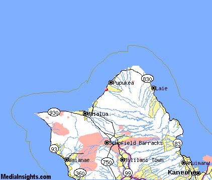
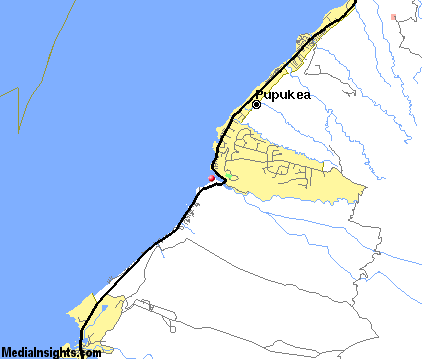
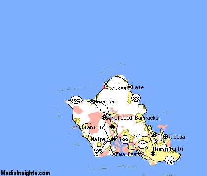
Waimea Bay Map & Transportation
|

|
|
 |
|
|
| Click each thumbnail image to enlarge. |
 |
|
 |
 |
The closest airports in the area are the Kalaeloa airport (JRF) located about 23 miles south of Waimea Bay in Kapolei, Hawaii.
|

|
Waimea Bay Attractions
|

|
|
| | | Water Parks |
| Hawaiian Waterworks | Ewa Beach | HI | 22.9 mi. | |
| | | Golf Courses |
| Kahuku Golf Course | Oahu | HI | 8.2 mi. | | | Mililani Golf Course | Oahu | HI | 13.0 mi. | | | Waikele Golf Club | Oahu | HI | 16.7 mi. | | | Pearl Country Club | Oahu | HI | 19.1 mi. | | | West Loch Golf Course | Oahu | HI | 19.1 mi. | | | Ewa Villages Golf Course | Oahu | HI | 20.6 mi. | | | Pali Golf Course | Oahu | HI | 25.5 mi. | | | Ala Wai Golf Course | Oahu | HI | 29.4 mi. | |
| | | State Parks |
| Kahana Valley State Park | | HI | 13.8 mi. | | | Keaiwa Heiau State Park | | HI | 19.9 mi. | | | He‘eia State Park | | HI | 21.7 mi. | | | Sand Island State Park | | HI | 26.6 mi. | | | Honolulu Stadium State Park | | HI | 29.1 mi. | |
| | | Museums |
| USS Bowfin Submarine Museum & Park | Honolulu | HI | 26.8 mi. | (History) | | Hawaii Museum of Flying | Honolulu | HI | 26.8 mi. | (Technology) | | Contemporary Museum | Honolulu | HI | 26.8 mi. | (Art) | | Honolulu Academy of Art | Honolulu | HI | 26.8 mi. | (Art) | | Bishop Museum | Honolulu | HI | 26.8 mi. | (History) |
| | | Zoos and Aquariums |
| Honolulu Zoo | Honolulu | HI | 26.8 mi. | | | Waikiki Aquarium | Waikiki | HI | 28.4 mi. | |
Notice a problem with the information on this page? Please notify us.
|
Disclaimer: We recommend you conduct your own research regarding all accomodations and attractions found on this website. The distances shown on this website are straight-line distances as the crow flies. The road distance may be considerably longer. You assume all liability for use of any information found on this website. No information is confirmed or warranted in any way. By using our services you agree to the terms and conditions of this disclaimer.
|
| We are the #1 site for your Hawaiian Vacation presenting Hawaii vacation rentals, hotels, weather and map for each city. |
Hawaiian Vacation and California Vacation are publications and trademarks of Media Insights, Inc.
©1997-2025 All Rights Reserved.
|
|